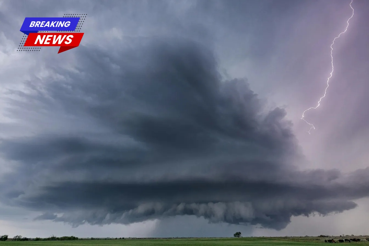
Southwest Texas and coastal Louisiana remain under a marginal risk for severe thunderstorms, as per the Storm Prediction Center’s Day 1 outlook issued late on April 30, 2026. Isolated storms in these areas could bring large hail and damaging wind gusts, mainly during the evening hours across Texas and in the afternoon along the Louisiana coast.
Although forecasters have expressed low confidence in widespread severe weather, there are pockets of instability and shear that could lead to brief, localized severe events. Local residents have been preparing for possible disruptions as convection develops along a stalled frontal boundary.
Storm Prediction Center’s Marginal Risk Breakdown
The Storm Prediction Center has identified the threat across southwest and south-central Texas, extending toward the middle Texas Coast, and southern Louisiana.
Thunderstorms are expected to form near the Texas Big Bend in the late evening, gradually spreading eastward overnight. Meanwhile, the storm activity over coastal Louisiana is expected to peak earlier in the day. While elevated storms dominate the forecast—limiting surface-based storm intensity—there are still potential hazards.
The probability maps suggest low chances for tornadoes, with odds staying below 2 percent. However, areas marked with a “hatched” pattern show isolated potential for stronger tornado spin-ups. Hail probabilities indicate the possibility of stones one inch or larger, and wind gusts could reach damaging levels of around 50 knots in certain locations. These graphics, based on ensemble models, emphasize the conditional nature of the setup.
Atmospheric Conditions Supporting Severe Weather Potential
Strong westerly winds aloft are expected to persist across the southern Plains, driven by an upper-level low moving eastward from off Baja California. A stalled surface front over south Texas will serve as the trigger, with ascent ahead of a shortwave trough sparking initial storm development.
Models such as the NAM 3km and HRRR show enough MUCAPE (most unstable convective available potential energy) to support hail in elevated supercells, though storm coverage remains uncertain.
In Louisiana, a front reinforced by convection extends southward, where instability is expected to build beneath ongoing storms. Deep-layer shear will support gusty outflows and marginal hail, even as weak-to-moderate CAPE (convective available potential energy) limits the potential for more severe events.
Forecasters expect that supercells moving through higher instability zones late in the night in Texas could briefly intensify, with winds potentially exceeding severe thresholds.
Primary Hazards and Peak Timing
Large hail is the top concern, with isolated reports possible of hailstones up to marginally severe sizes in areas where supercells organize. Damaging winds are also a concern, as downdrafts strengthen in sheared environments. The tornado risk is low, confined to weak spin-ups, if any, due to modest low-level helicity.
The peak timing of these storms is expected to align with the diurnal heating cycle: coastal Louisiana will see threats increase through the afternoon, while storms in Texas will ramp up from late evening into early Friday morning.
The highest storm indices are expected to be between late afternoon and late evening, as indicated by model animations. Forecasters have stressed the need for real-time updates from the Storm Prediction Center to refine these predictions as conditions evolve.
A Modest but Watchable Setup
The atmosphere in the marginal risk areas will be moderately unstable, with SBCAPE (Surface-based Convective Available Potential Energy) ranging from 500 to 2500 J/kg, and MLCAPE and MUCAPE in similar ranges to support storm development. Shear values impressively reach 50-70 knots through the 0-6 km layer, which could help storm organization despite lifted indices ranging between -3 and -6.
Helicity metrics—which indicate the likelihood of rotation—show values of 50-150 m²/s² for 0-1 km SRH (Storm-relative Helicity), and 150-250 m²/s² for 0-3 km SRH, suggesting low to moderate rotation potential. Supercell composite parameters sit between 2-6, and the significant tornado parameter is between 0.3-0.7, below the thresholds needed for major tornado outbreaks.
The dewpoints range from 58-73°F, and the mid-level lapse rates are between 6-7.5°C/km, fostering gusty, hail-bearing storms but not widespread severe weather.
What to Expect Moving Forward
As the situation develops into Day 2, there is potential for further intensification, especially in the southern Plains. Forecasters have urged the public to rely on official sources like the Storm Prediction Center and local emergency management for the most up-to-date information. In a time when spring weather patterns can change quickly, even marginal risks remind communities to stay vigilant and prepared.